Recent Posts

Pages: [1] 2 3 ... 10
1
Beyond Southern Yosemite / Re: Shaver Lake
« Last post by mungeclimber on February 27, 2025, 06:31:16 pm »
Outstanding! Thx for sharing!  The old pins look cool! Wonder about those now!

I'll probably hit Minarets before I head to Stevenson, but I'll keep it in the back pocket to explore.

2
Beyond Southern Yosemite / Re: Shaver Lake
« Last post by daniel banquo merrick on February 25, 2025, 08:25:23 am »
Bob and I went back there in 2014. Cool place to explore. Also slabs along the river.
https://danielmerrick.com/SOYO_photos/MDR/photos.html
3
Beyond Southern Yosemite / Re: Shaver Lake
« Last post by mungeclimber on February 24, 2025, 11:00:41 am »
Anyone seen pics of Stevenson Falls? There appears to be a shit ton of granite slabs in that area. Ebike-able to the bridge? 
4
Wawona Dome Area / Re: Chilnualna Falls area?
« Last post by mungeclimber on January 19, 2025, 07:55:12 pm »
Not yet, but some reasonable angled slabs in pics the day I posted this. Seems like reasonable trail to the falls, then cross the river somehow and viola Bob's your uncle.
5
Wawona Dome Area / Re: Chilnualna Falls area?
« Last post by daniel banquo merrick on January 18, 2025, 07:01:17 am »
Never heard of it, have you been there?
6
Wawona Dome Area / Chilnualna Falls area?
« Last post by mungeclimber on January 13, 2025, 07:51:39 pm »
Anyone done anything out that way?

I'd post a pic but attachments aren't writable... "The attachments upload directory is not writable. Your attachment or avatar cannot be saved."
7
Mammoth Pools Area / Re: Old photos around Mammoth Pool and Balloon Dome
« Last post by mungeclimber on October 03, 2024, 10:26:04 pm »
thx for the old map link Dan. I can't attach to posts anymore for some reason. But the creek is right near Jackass rock.
8
Mammoth Pools Area / Re: Old photos around Mammoth Pool and Balloon Dome
« Last post by daniel banquo merrick on October 02, 2024, 08:08:59 am »
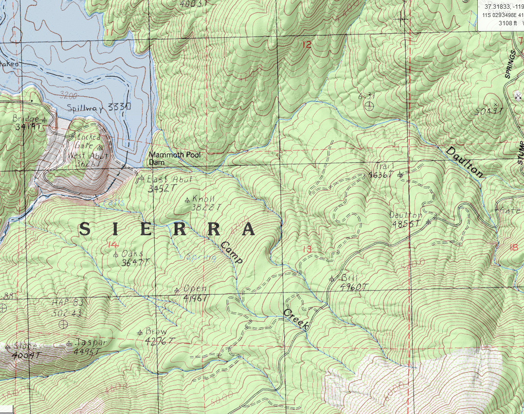
I'm not sure where Graveyard Creek is. I suspect that the foreground of the photo is the dome at the dam looking south to where Camp Creek cascades down the cliffs. It would be easy to check if anyone went there.


I just found out that Mammoth Pool was a pool in the river just above where the dam is now. 1953 map before the dam was built:
https://danielmerrick.com/SOYO_photos/maps/CA_Shuteye%20Peak_301705_1953_62500_geo.pdf
9
Mammoth Pools Area / Re: Old photos around Mammoth Pool and Balloon Dome
« Last post by mungeclimber on October 01, 2024, 01:12:58 pm »

There is a picture showing "Flat Top Dome" and "Graveyard Creek" but I don't think it is Graveyard Peak. Perhaps somebody recognizes where the photo was taken. It may be under water now for all I know.
https://calisphere.org/item/98f53d18a3522de5c932c418a67b4558/

This sure seems like where the current dam is located on Mammoth Pool. Note that Graveyard Creek drains into Jackass Creek way down stream. One might read the arrow in the picture as pointing down stream in the direction of where those drainages are... effectively showing the flow direction of the river below?

10
Shuteye Ridge Area / Re: Weekly Favorite Shuteye Ridge PICS thread
« Last post by mungeclimber on August 03, 2024, 09:42:52 pm »
May 2013

Pages: [1] 2 3 ... 10